RAJMACHI - A TREK WITH PLEASANT SURPRISES
Adjusting schedules in 12th standard is not easy for any student. Yet, after so many fights, discussions, lump sums, we convinced our parents. We were a group of 6 people and went up there on 16th July, 2016. We don't usually travel together, but when we do, we make sure that it's memorable. Rajmachi was one of them! It was an "Almost Cancelled" trek, because we initially planned for Peb-Vikatgad (Near Neral), but cancelled it as one of the student lost his life in a landslide just a week before our trek. So obviously, our parents were so worried about us and didn't want us to go. But nothing stands before passion! Against all the odds, we gathered some courage, buckled ourselves up, and went for the trek!
It was once again in the same year, we were set to trek it! We took the very first train at 4.59 AM from Thane station to Karjat. We reached there by 6.30 AM and went to the bridge. We took a TumTum to the base village of Rajmachi fort, Kondivade village. It was 9 in the noon, we started walking. The atmosphere was pretty pleasent.
 |
| A lake at Kondivade Village |
I did the same trek two years ago, but only till halfway. So basically, we were totally clueless about what we were going to face ahead. Rain drizzled as we started. For the first time in my life, I regretted that all of us forgot to bring Odomas. It's a common sense that we should not use such things in jungle, but various species of mosquitoes treated us like we were their only meal. We kept on walking & we reached the base Plateau, from where the actual fort starts. We purposely chose the Karjat side, because from Lonavla side, the trek is just a normal hike. And nowadays, there are bridges from Lonavla side so you can directly go to the top by a car. But from Karjat side, there's a beautiful and tiring rock patch which will force you to take rest after every 30 minutes.
 |
| The base Plateau |
We rested for a while, having some energetics, deciding the plan ahead. Because last time, I returned from that plateau, as I came with my school. From now, everyone of us was totally a stranger to the jungle ahead. Being clueless about what is next, we started to hike again, looking for a route, me and one of my friends lead the troop. We selected a small hiking road, (PAYVAAT in Marathi) and kept following that. There were many situations where there were 2 or more diversions for a same road. We decided to follow the road which was not in good condition; because the main reason it was not in condition would be it was used frequently and lead to the fort. I learnt some amateur skills of Jungle Reading in this trek, which anyone can learn with a small practice.
We arrived to the Rajmachi Village. We reached there by 11.30, and honestly, I thought the trek was over as my knees were paining after clearing such a rock patch. We sat there for a while, refreshed ourselves, and sat around and the question aroused. "What now?". We all were tired. After a 10-15 minutes discussion, nothing was concluded. It was already 12.00 PM and I was thinking about returning as we had to reach home soon (because our parents told us to do so). There were travelling problems, if we reached to the base after sundown. I was pretty confused. Finally, we concluded to hike further and not wasting time on discussing stuff. We consulted a local woman who guided us the path to the main fort. We started walking ahead. But we were misguided. We were lost. We stopped, and again that argument came up, whether to stay or not! Someone said," We've made it 'till here. It's only a matter of an hour or two. We shouldn't regret about it later." Everyone agreed to this. And then, the best part of trek happened.
We decided to hike further and 2 fellow trekkers met us. We were noobs for the place, so we asked them the path, hoping that they will guide us correctly. The best part is, they were also new to this place. So we grouped up and went together. So the group of 6 was now a group of 8.
 |
| Fog after the rain |
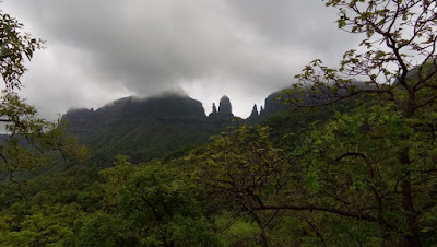
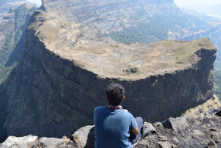
We reached the gate of fort at about 12.30. The fort is divided in 2 parts, i.e., 2 citadels. The higher one, where the peak point of fort is situated, Shreevardhan; and the other was Manranjan. Once again there was a question! Now Shreevardhan or Manranjan? We decided to go onto Shreevardhan. Once you reach the fort, the hike is not that lengthy, but not too easy! Hardly 30 minutes hike remains. We started to walk and the rain started to pour. The wind was so heavy that created fog everywhere. Within 5 minutes, we were completely fog-zoned. Fog fog everywhere! The cool breeze and shivering made us crazy. Honestly, if we would have returned from the village, we would have missed a lot of things. We were shouting, dancing all around in the rain, clicking selfies and much more craziness. This was a perfect moment to capture!! We kept on going. We reached the peak point of fort around 1.00 PM. Sat there for a while, had some snack, and departed.
 |
| A peek from peak point |
We felt ourselves so lucky, that when we were approaching down, the local crowd began to mess up on the fort. So we didn't feel any unpleasantness up there. The rain was good & so was the atmosphere. We had lunch in a small cave which was used as a warehouse back then. We kept on descending pretty fast, as we had a time constraint. There were many waterfalls which grabbed our attention. We threw our bags on a side, and sat in the stream getting fully wet and with constant rainfall. Well, that was a part of our enjoyment.
 |
| The group of 8 eventually formed. |
Being very happy about the day, finally reached where we started. Kondivade village. We said a good bye to our fellow trek mates, and departed for Karjat station, around 4.30 PM.
After arriving, we had some snack and returned to Thane station, (you won't believe, because even we didn't) at 6.00 PM. We were so happy, that we decided to do a small celebration. We went to 'Hotel Amantran' and ate MisalPav (Very common for M.H People). And departed to our homes.
It was a great, unforgettable trek indeed. Atleast there is no chance of regretting what we missed. Because, we missed NOTHING.
##All photographs are clicked by Chinmay Parulekar.


Comments
Post a Comment